 |
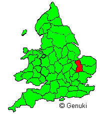
"Cambridgeshire, (Cambs.) inland
eastern county of England; bounded North by Lincolnshire, East by
Norfolk and Suffolk, South by Essex and Herts, West by Bedfordshire,
Huntingdonshire, and Northamptonshire; greatest length, North and
South, 48 miles; greatest breadth, East and West, 28 miles; average
breadth 16 miles; area, 524,935 acres; population 185,594. The North
section of the county, including the Isle of Ely and part of the Great
Bedford Level, is a large flat expanse of country, which, for the
most part, formerly consisted of fen and marsh. It is now intersected
in all directions by wide trenches or canals. The land, thus drained
and reclaimed, is a rich, black soil, and bears excellent crops. From
this tract the pleasant vale of the Cam stretches away to the south-west,
and contains a great number of excellent dairy farms. Cambridgeshire
comprises 17 hundreds, 172 parishes with parts of 7 others, the parliamentary
and municipal borough of Cambridge (1 member and Cambridge University
2 members), and the municipal borough of Wisbech (pronounced Wizbeech)."
[Bartholemew's Gazetteer of the British Isles, 1887]
FOWLMERE
"FOWLMERE, in Domesday Book "Fugelesmare, is a parish,
6 miles north-east from Royston, 2½ south-east from the Shepreth
station on the Hitchin, Royston and Cambridge line of the London
and North Eastern railway, and 9 south from Cambridge, in the hundred
of Thriplow, petty sessional division of Arrington and Melbourn,
union and county court district of Royston, rural deanery of Barton,
archdeaconry and diocese of Ely."
"The soil and subsoil are chalky and gravelly. The chief crops
are wheat, oats, barley, beans and green crops. The area is 2,272
acres ; the population in 1921 was 494."
[Kelly's Directory - Cambridgeshire - 1929]
|